No-Code Form Builder

Build custom forms effortlessly with our intuitive, no-code interface—no programming required. Designed for teams of all skill levels to create, edit, and deploy forms in minutes. Capture accurate field data from mobile or desktop devices, with full offline support. Streamline workflows and ensure consistent data quality across your organization.
Get Quote

Intelligent Mobile App

Empower your field teams with a smart, responsive mobile app built for real-world conditions. Capture geo-tagged photos, videos, signatures, and form data—all in one place. Works seamlessly online and offline with automatic sync and data validation. Get real-time updates, task assignments, and instant alerts on the go. Built for speed, accuracy, and usability across all mobile devices.
Get Quote

Why Choose NeuSpatial?

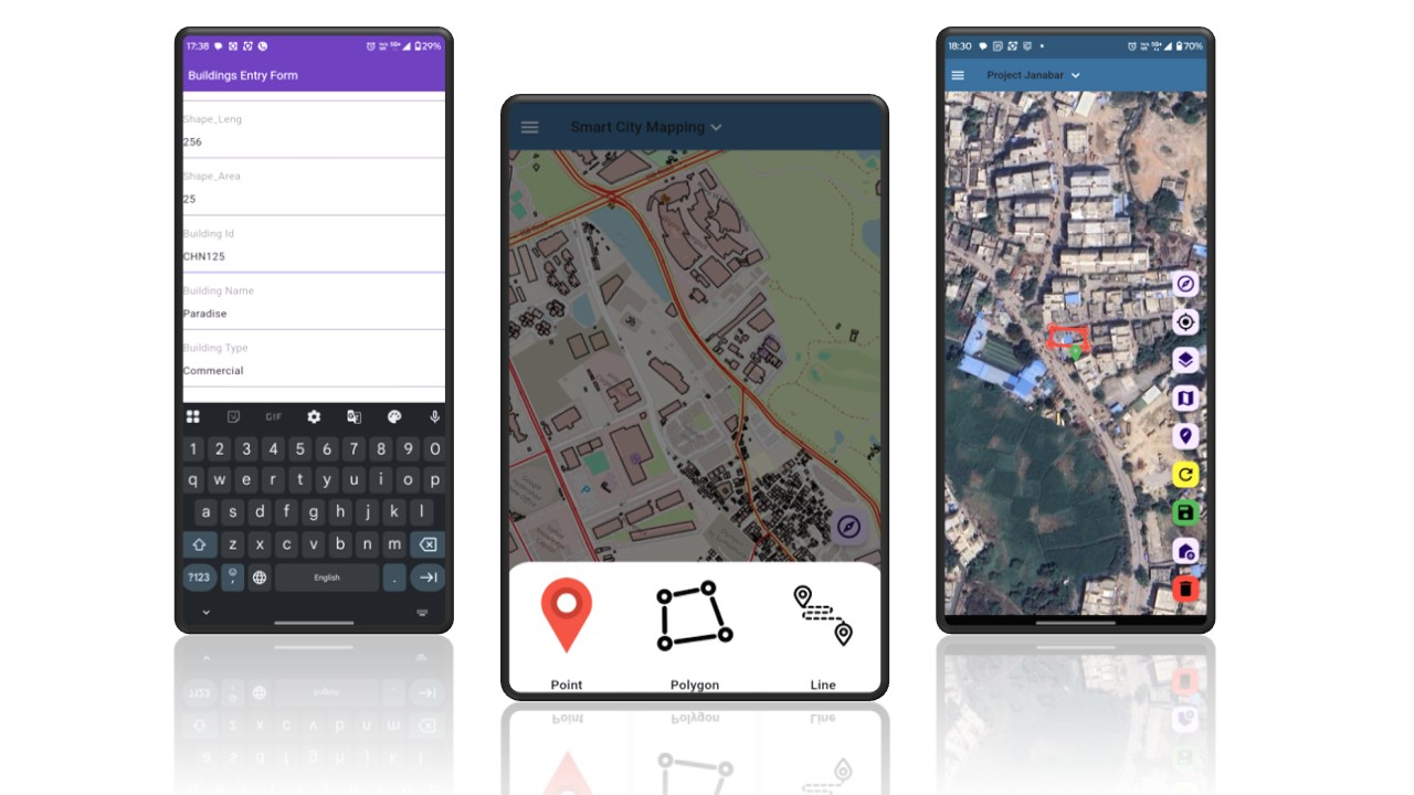
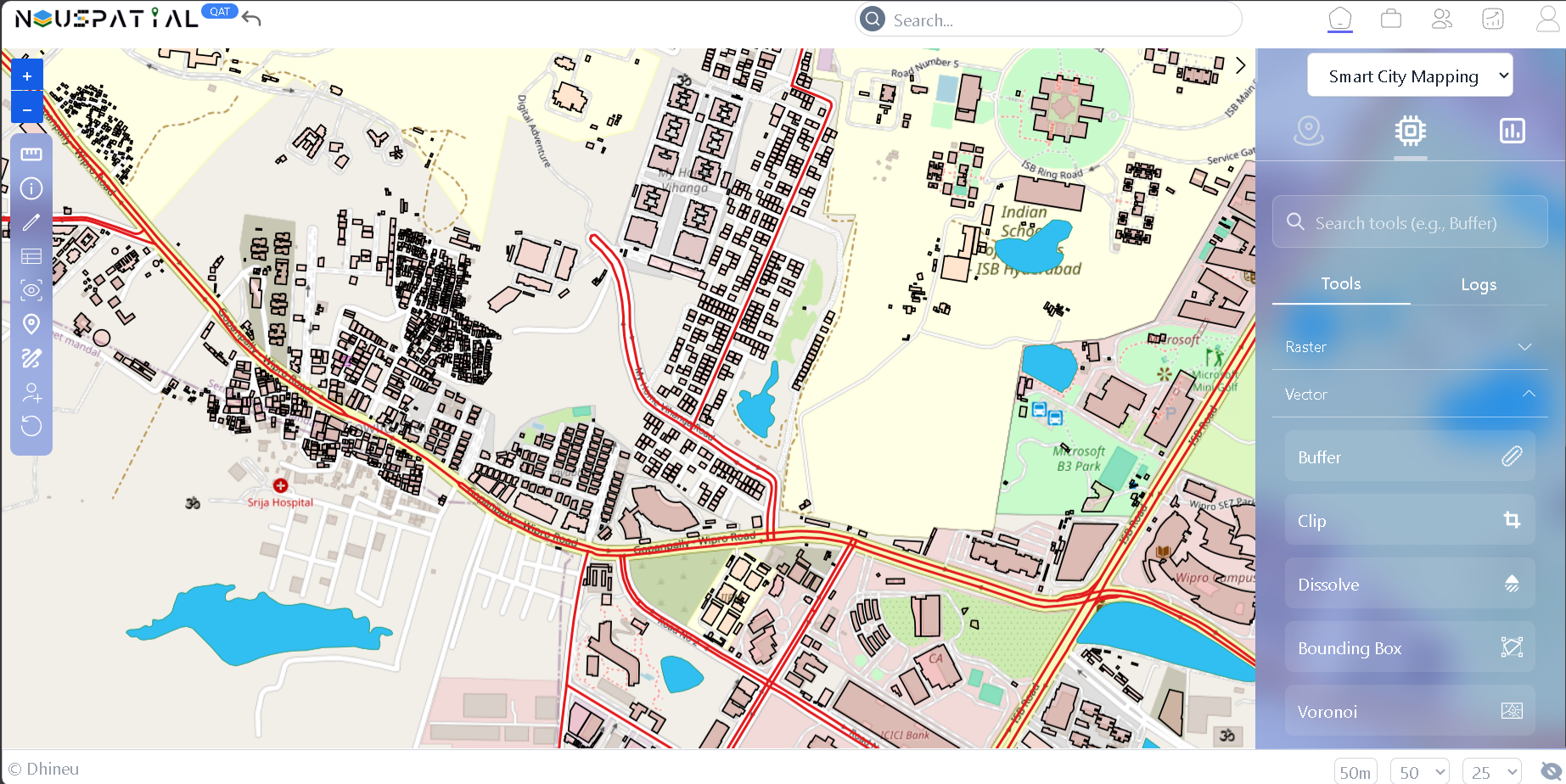
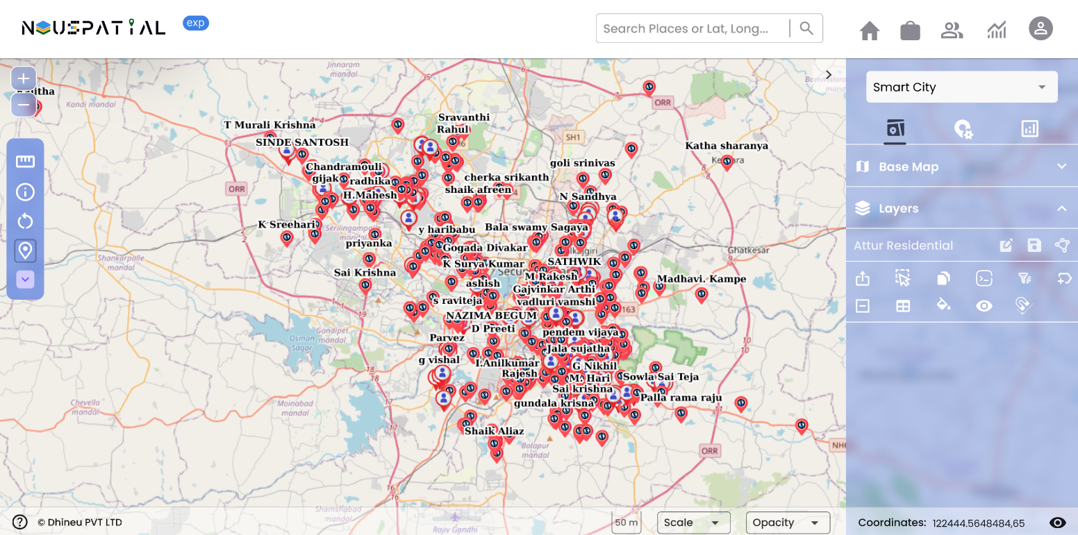
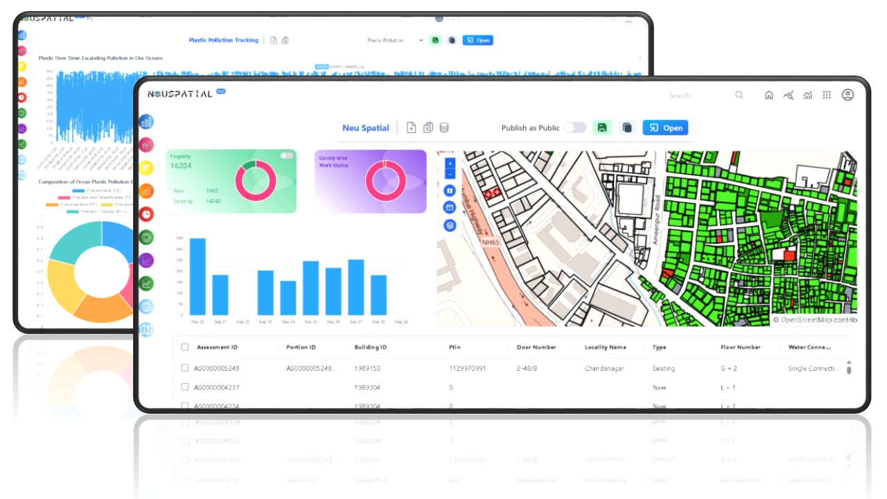
Move beyond fragmented tools. NeuSpatial offers a unified, intelligent, and flexible
platform designed for modern geospatial challenges.

Bring Your Own DB
Our platform supports seamless integration with external databases, allowing clients to connect their own data sources securely. This ensures flexibility, data ownership, and real-time analytics without data migration.
No-Code WebGIS Dashboard
Easily design and publish interactive maps and spatial dashboards without writing a single line of code. Empower users to visualize, filter, and analyze geospatial data through a drag-and-drop interface.
End-to-End GIS Platform
A comprehensive solution covering the full GIS workflow—from data collection, processing, and analysis to visualization and reporting. Designed to support scalable, multi-source geospatial operations across web and mobile environments.
AI-Driven Spatial Intelligence
Leverage advanced AI and GeoLLM capabilities to extract insights from maps, satellite imagery, and spatial data using natural language queries. Our platform combines computer vision, geospatial analytics, and large language models to enable intelligent decision-making and automated reporting across sectors.

Geo-processing Suite

Unlock the full power of spatial data with our comprehensive geo-processing tools. Perform everything from basic buffers and overlays to advanced spatial analysis. Run complex operations directly within the platform—no additional tools needed. Gain fast, reliable spatial insights to support smarter, data-driven decisions.
Get Quote

No-Code Storyboard & GIS Dashboard

Build and publish interactive dashboards without writing a single line of code. Blend maps, charts, tables, and media with live IoT sensor feeds for full 360° situational awareness. Drag‑and‑drop designer lets anyone create story‑driven views in minutes—no GIS expertise required. Real‑time data streams, granular permissions, and offline snapshots keep every stakeholder in sync. Share privately or publicly to drive faster, evidence‑based decisions across your organization.
Get Quote

How NeuSpatial Works

From field to dashboard—NeuSpatial helps you collect, analyze, and act
on spatial data with accuracy and agility.

No-Code Survey Builder
Define Workflow Logic
Mobile Data Capture
BYO-DB Integration
Geoprocessing Tools
AI Anomaly Detection
Live Team Tracking
Active Users
AI-Powered Recommendations
Custom Exportable Reports

Live Project Monitoring

Keep track of your projects in real-time with our comprehensive monitoring dashboard. Monitor field teams, track progress, manage resources, and ensure project milestones are met with live updates and automated notifications.
Get Quote

Enterprise Integration

Seamlessly integrate NeuSpatial with your existing enterprise systems. Our robust API and connector ecosystem ensures smooth data flow between your GIS platform and business applications, maintaining data consistency and operational efficiency.
Get Quote

Get a Demo or Contact Us

Fill out the form below to request a personalized demo, and our team will
get back to you shortly.

Let's Connect

We're excited to show you how NeuSpatial can transform your geospatial operations. Reach out and let's start the conversation.